Nasa topographic data
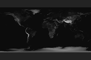
Nasa is a great general source for earth related maps be it weather, temperature, or topographical. In the following source we can get some height maps of earth: https://visibleearth.nasa.gov/images/73934/topography
This source is great for topographic data of larger regions i.e. continents or whole countries.
You can one image of the entire planet or eight divides one with higher resolution

Comments
Post a Comment